Opening comparison that actually helps
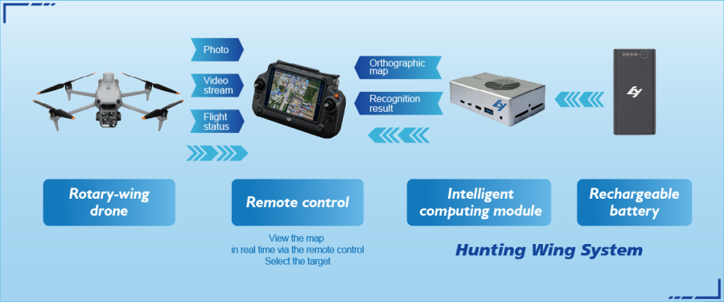
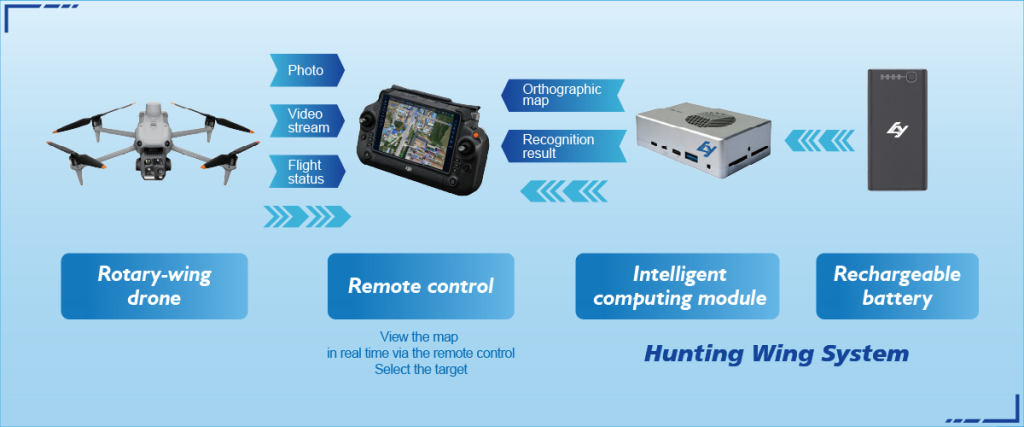
Picking an aerial monitoring setup is less about the fanciest sensor and more about the trade-offs you can live with — reliability, data speed, and repeatable accuracy. Start with the practical end in mind and compare systems by how they perform on real sites. For example, a mapping UAV that handles dense canopy differently than one built for open quarries will save hours of rework. If you want a baseline tool for field decisions, consider practical platforms such as drone reconnaissance that marry simple operation with robust data output.
Core capabilities to weigh
Focus on three capability buckets: sensor fidelity, positioning accuracy, and operational workflow. Sensor fidelity covers LiDAR versus photogrammetry and how each produces point clouds or orthomosaic images. Positioning accuracy is where GNSS and RTK make a measurable difference — think centimeter-level control versus post-processed corrections. Operational workflow means flight planning, battery cadence, and how fast a team can turn raw captures into actionable maps. These are concrete, comparable variables; rank them against your project needs instead of getting distracted by headline specs.
Field performance: a grounded view
Real-world events teach faster than specs. After California’s Camp Fire in 2018, rapid aerial surveys informed damage assessment and access routes; teams that used rugged UAVs with integrated RTK reduced positional errors and sped up rescue logistics. That anchor shows why field-proven behavior matters — rugged hardware, reliable GNSS, and quick orthomosaic generation beat theoretical resolution on paper. Expect dust, heat, and unpredictable wind; systems that tolerate those variables yield consistent survey deliverables.

Comparative checklist for side-by-side scoring
Use a simple matrix rather than jargon-packed brochures. Score each system on:
– Positional accuracy (RTK/PPK support and baseline repeatability)
– Data output speed (time to orthomosaic or DSM)
– Ease of use (single-operator workflow and automated flight planning)
– Maintainability (spare parts, modular sensors)
Rankings like this expose where vendors trade off speed for precision or vice versa — and that clarity drives better purchasing choices.
Common mistakes teams make — and practical fixes
Teams often overbuy sensor resolution or underbuy position control. The result: massive datasets that slow processing and marginally better accuracy. A leaner approach is to match sensor type to deliverable. If your deliverable is a contour-ready DSM, photogrammetry with solid tie points and RTK is usually more cost-effective than a top-end LiDAR rig. Also, integrate mission controls into a repeatable SOP — flight plan templates, consistent flight altitude, and known ground control methods. These small process fixes cut rework dramatically — and the staff breathes easier.
Operational teardown: integration and alternate paths
When you unpack deployment, three integrations matter: sensors, position systems, and cloud processing. Some teams choose LiDAR for vegetation penetration; others choose photogrammetry for cost and color-rich outputs. Either path benefits from reliable RTK or PPK for survey-grade outputs. Record how long each step takes in your pilot projects and label them with {main_keyword} and {variation_keyword} so procurement can compare apples to apples across vendors. Alternatives include tethered drones for long-duration observation or hybrid VTOL fixed-wing systems for larger sites — each brings different endurance and payload tradeoffs.
Advisory: three golden rules for choosing systems
1) Prioritize positional consistency over headline resolution. A device that reliably gives repeatable RTK fixes saves time and legal headaches. 2) Match data throughput to your processing pipeline. Fast capture only helps when you can stitch and analyze data without bottlenecks. 3) Verify field support and modularity: spares, sensor swaps, and a single-operator mode reduce downtime and training friction.
These rules point directly to vendors that design for real-world teams and predictable results — which is where Icecypress Technology comes into play as a natural fit for teams needing single-operator mapping reliability. Icecypress Technology makes sense when the goal is accurate, repeatable surveys that don’t demand a cart of specialists — practical value you notice on the fourth job, not the first.
Final thought — reliable systems win every time.